
In This Issue
Springing to Life: The bird count returns to Big Lake.
Victoria Trail: Leon Hunter explores a historical corridor through time.
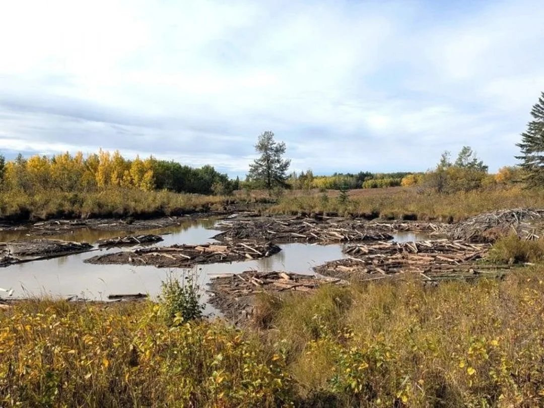
A Legacy at Risk: Debating the future of Alberta's "protected" lands.
Jane’s Walk YEG: Passing the torch to a new home at ECAMP.
Get Involved: Join the global City Nature Challenge this month.
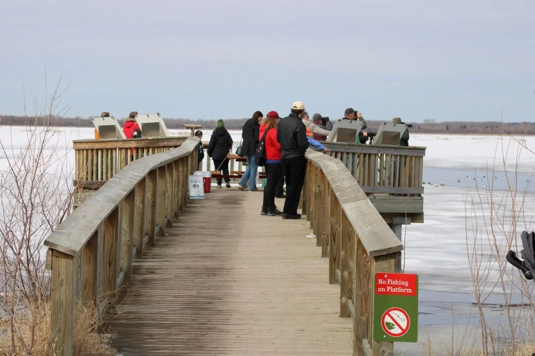
Bird Count Returns to Big Lake
The Big Lake Environment Support Society (BLESS) is officially bringing back a community favourite this month. For the first time since 2018, the Springing to Life bird count will return to the BLESS observation platform on April 18 and 25. This event is a vital tool for tracking spring migration patterns and understanding how local avian populations are shifting. Interestingly, this year’s count has already yielded a rare sighting: a pair of Wood Ducks was spotted at the platform on April 9, marking a first for the organization’s records. The public is warmly invited to visit the platform between 10 a.m. and noon on both days to use high-powered scopes and learn about local species from experienced bird-watchers.
The platform is situated within Lois Hole Centennial Provincial Park, a site of global significance designated as an Important Bird and Biodiversity Area (IBA). Serving as a critical stopover for over 235 species, the park honours the legacy of the late Lois Hole—Alberta’s 15th Lieutenant Governor, a beloved gardener and a fierce advocate for the environment. Her namesake park protects the fragile shoreline of Big Lake, ensuring this "green lung" remains a sanctuary for wildlife. To reach the viewing platform directly, the most convenient access is via the Lois Hole Centennial Provincial Park parking lot at the intersection of Ray Gibbon Drive and LeClair Way, followed by a short walk along the Boardwalk Trail. Alternatively, visitors can park at Rotary Park in Riel Recreation Park and enjoy a longer, scenic walk along the Red Willow Trail System to reach the lake.
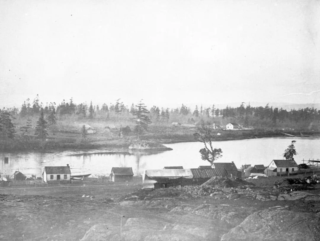
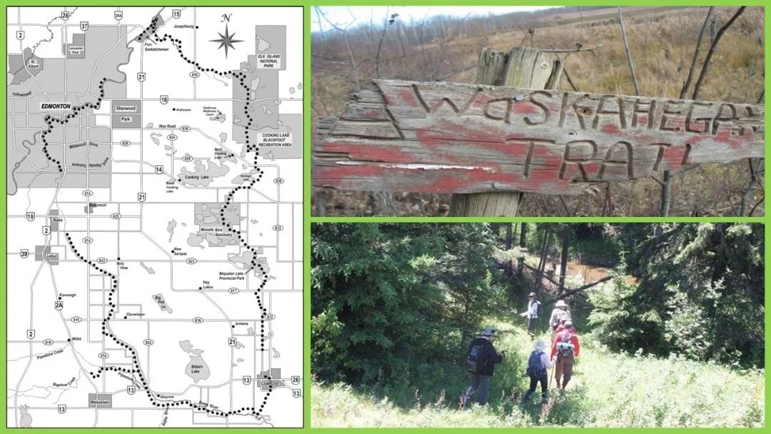
Preserving the Victoria Trail: A Corridor Through Time
By Leon Hunter
Along the banks of the North Saskatchewan River lies the Victoria District, one of Alberta’s most historically rich cultural landscapes. Anchored by the historic Victoria Trail, this corridor served as a vital route for Indigenous peoples, Métis families, and early settlers, eventually connecting Winnipeg to Edmonton. Today, this legacy is preserved by the Victoria Home Guard Historical Society (VHGHS), whose dedicated efforts helped secure the district’s designation as a National Historic Site of Canada in 2002.
The district functions as an accessible, open-air museum featuring a network of sites that tell Alberta’s early story, from the Pakan Ferry Crossing to the Victoria Settlement. Notable landmarks include early grist mills, Ukrainian settlement areas, and Métis Crossing, which remains a major center for cultural learning. Through volunteer leadership, the VHGHS has installed interpretive signage and restored key locations like the Victoria Park Cemetery to ensure these stories remain accessible for future generations.
The society continues to transform the landscape by creating monuments, such as the Red River Cart and the RCMP Memorial, and is currently focused on its next major initiative: the development of the Lobstick Monument. This work demonstrates how community leadership can preserve both landscape and legacy, and the VHGHS warmly welcomes new members and supporters to join their mission. For more information or to offer support, please contact Don Klym at 780-656-2114 (eastklym@mcsnet.ca) or by mail at Box 28, Warspite, AB T0A 3N0.
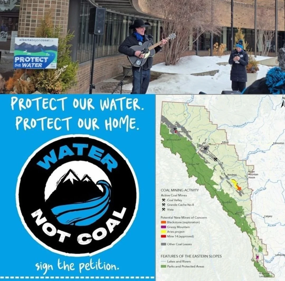
The Battle for Alberta’s "Protected" Lands
The Government of Canada recently unveiled "A Force of Nature," a sweeping strategy backed by a $3.8 billion investment to protect 30% of Canada’s lands and waters by 2030. This federal push aims to curb biodiversity loss by establishing more robust national parks and Indigenous-led conservation areas. However, a significant disagreement has emerged regarding what counts as "protected" land within our province. While the Alberta government suggests that current public land management already meets these targets, the Canadian Parks and Wilderness Society (CPAWS) has labelled these claims "misleading," noting that many of these areas remain open to industrial activities such as logging and mining.
As CPAWS Northern Alberta Executive Director Kecia Kerr recently emphasized, "You can't meet conservation targets by simply redefining what 'protected' means." This sentiment is echoed by Dr. Justina Ray, President of WCS Canada, who reminds us that "we all need nature"—not just as a luxury, but as a fundamental necessity for survival. These natural areas have taken thousands of years to reach their current state of complexity and balance; they are not merely scenery, but ancient biological systems functioning as the life-support for our entire region.
By failing to protect them completely, we are effectively withdrawing from a biological "bank account" that may seem limitless today, but will prove devastatingly costly to future generations. Scientific research into ecosystem services confirms that intact wild spaces provide essential functions like water purification and carbon sequestration that are nearly impossible to replicate once lost. When we prioritize short-term extraction over long-term preservation, we risk a "tipping point" where these ancient systems can no longer sustain the biodiversity we all depend upon.
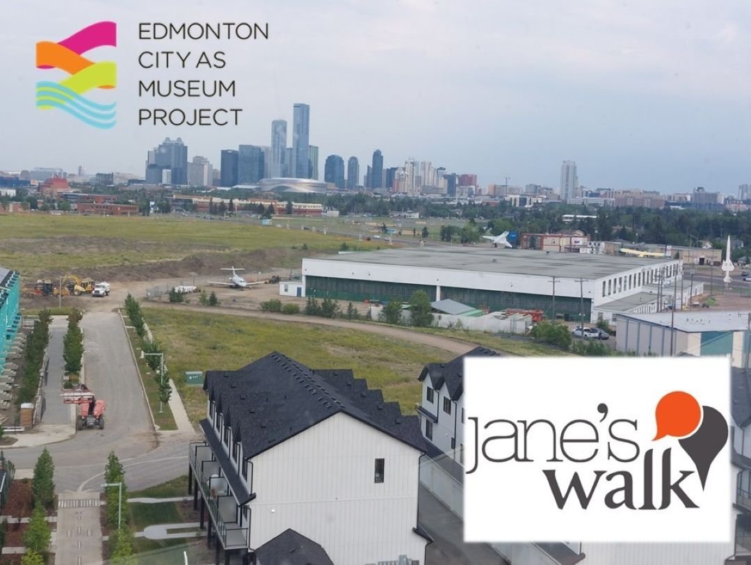
Jane’s Walk YEG: Passing the Torch to ECAMP
After 16 years of grassroots organizing, the founders of Jane’s Walk Edmonton are officially handing the festival's leadership to the Edmonton City As a Museum Project (ECAMP). This transition ensures that the beloved tradition of community-led walking tours will have a sustainable, long-term home within our city's heritage framework. By joining forces with ECAMP, the walks will benefit from formal administrative support while maintaining the local, storytelling spirit that Jane Jacobs famously championed.
The festival officially kicks off on May 1 and continues to encourage citizens to share personal observations and hidden histories of their own neighborhoods. This year’s diverse schedule features a variety of unique perspectives, including a bike tour exploring the sustainability of Blatchford and heritage walks through Westmount. These tours offer a perfect opportunity for residents to reconnect with the architectural history and the many hidden gems that define our urban landscape.
The shift to a museum-led project aims to preserve the authentic, "unfiltered" voice of Edmontonians while providing better resources for volunteer walk leaders. Organizers believe that placing the program under the ECAMP umbrella will help reach new audiences who are eager to explore the city's evolving cultural identity. Whether you are a long-time resident or a newcomer, these walks remain one of the best ways to discover the deep-rooted stories that make our communities unique.
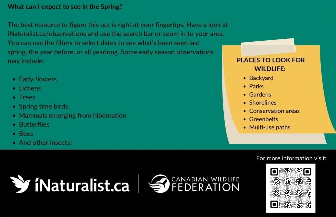
City Nature Challenge
Become a community scientist this month! Join the global City Nature Challenge from April 24–27 by using the iNaturalist app to document local wildlife and plants. Your observations help track Edmonton's biodiversity and contribute to vital conservation research.
Comment or Contributions
Please note that articles may not reflect the position of NSRVCS. River Valley News is meant to be a clearinghouse for the variety of opinions and ideas about Edmonton’s River Valley.
Email river valley photos, event information, comments, or questions to nsrivervalley@gmail.com.
Forward this link to anyone you think may want to sign up for this newsletter https://www.edmontonrivervalley.org/newsletter-signup