In This Issue:
The Rossdale Vision: A world-class central park or high-density urban housing?
Beaver Hills Growth: 65 hectares of vital "natural sponge" protected near Edmonton.
Trailblazing History: Trekking 309 kilometres of glacial ridges and river valleys.
Wildfire Ready: Free local workshops to help your neighbourhood handle emergencies.
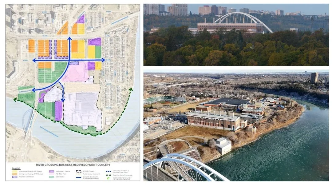
Photo credit: City of Edmonton / CBC News
The Vision for a Central River Valley Park
In a recent Edmonton Journal opinion piece, long-time advocate Eric Gormley presented a bold vision for the historic Rossdale flats: the creation of a massive, world-class central park. Gormley argues that rather than fragmenting this precious area with high-density residential development, the City should seize the opportunity to establish a gathering place comparable to Vancouver’s Stanley Park or New York’s Central Park. This vision emphasizes the preservation of open space and the restoration of natural ecosystems, suggesting that a dedicated park would serve as a far greater long-term asset for Edmonton’s identity and tourism than a standard infill project.
By prioritizing public parkland over private housing, Gormley suggests the City could transform the decommissioned power plant and surrounding flats into a cultural and ecological hub. This approach would provide much-needed relief for a growing downtown population while protecting the unique historical character of the site. Instead of rushing into $15 million worth of infrastructure to support 2,600 new housing units, the argument is that these funds—and the land itself—should be reinvested into a cohesive, accessible green space that honors the river’s edge for all Edmontonians.
The Edmonton River Valley Conservation Coalition (ERVCC) echoed these concerns at the City’s Executive Committee meeting this past Thursday, March 26. Speaking against the proposal, the ERVCC highlighted the potential disruption of a vital wildlife corridor and the critical lack of meaningful Indigenous consultation. They specifically argued that building high-rises and concrete promenades on a former burial ground and active flood plain is both ecologically irresponsible and culturally insensitive. With the Committee's recommendation now moving toward a final vote at an upcoming City Council meeting, the ERVCC maintains that the priority must remain protecting the valley’s integrity rather than its conversion into a commercialized "concrete park."
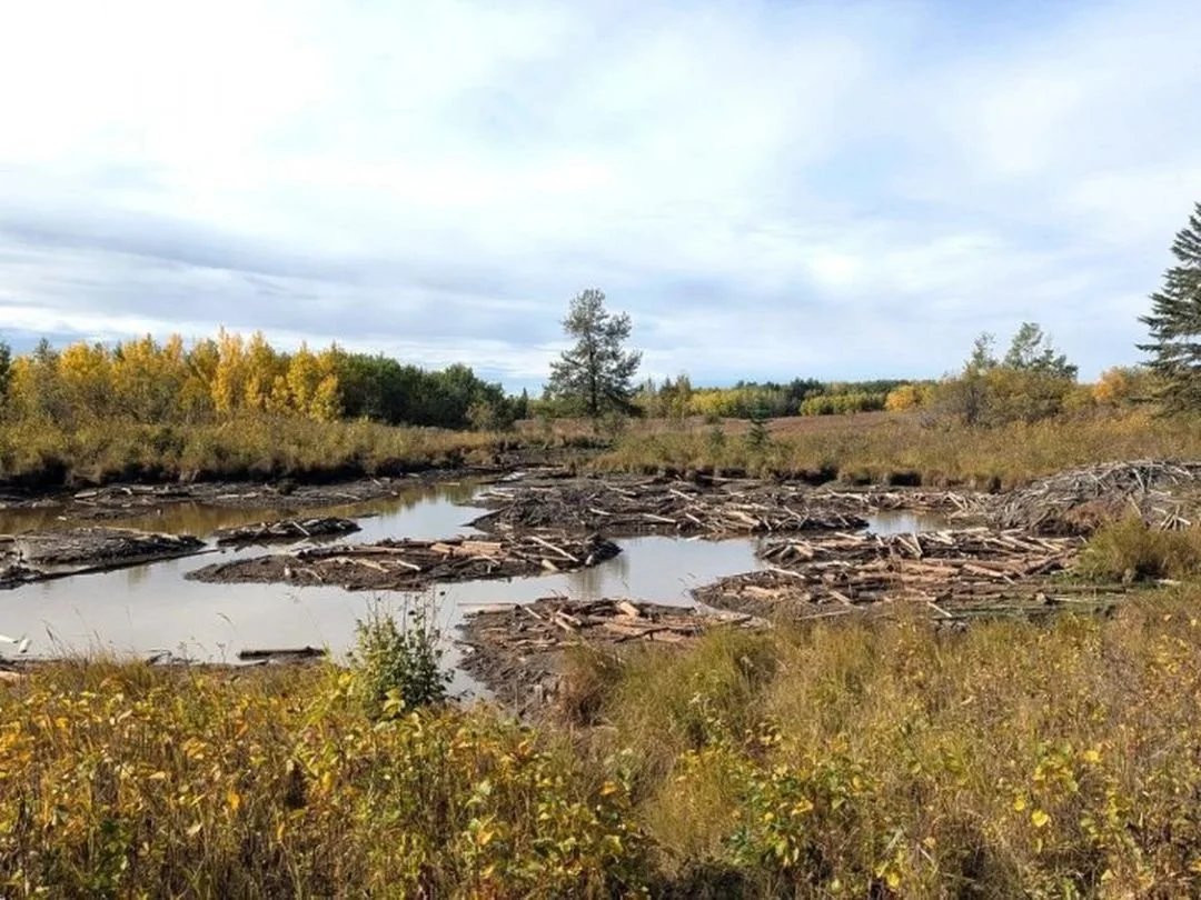
Photo credit: Sherwood Park News / Kasia Podilsky
65 Hectares Conserved in the Beaver Hills
Coinciding with the 10-year anniversary of the Beaver Hills Biosphere, the Nature Conservancy of Canada (NCC) has announced the conservation of the West Wanisan Lake property, located just 27 kilometers east of Edmonton. This 65-hectare project on the Cooking Lake Moraine acts as a vital "natural sponge," using its wetlands and forests to absorb spring melt and storm runoff. By holding water on the land and slowly recharging local aquifers, the site serves as essential infrastructure that helps the surrounding region withstand the increasing threats of both floods and droughts.
The property is a critical link in the wildlife "highway" that connects Elk Island National Park to the north and Miquelon Lake Provincial Park to the south. By protecting this stepping stone, the NCC ensures that wide-ranging species like moose and fisher can move safely through the landscape. The area is also a haven for migratory birds, including several species of concern like the western grebe and black-crowned night-heron. The presence of beavers on the land further enhances this resilience, as their dams naturally slow water flow and maintain wet habitats even during dry periods.
While the site is currently being prepared for public access, it will eventually offer Edmontonians a new way to connect with an internationally recognized UNESCO Biosphere in their own backyard. This project was made possible through a collaboration of donors and partners, including the Government of Canada and Cenovus Energy. Notably, the property protects a key segment of the Waskahegan Trail, a historic 309-kilometre hiking route that winds through the region's most scenic and ecologically significant landscapes.
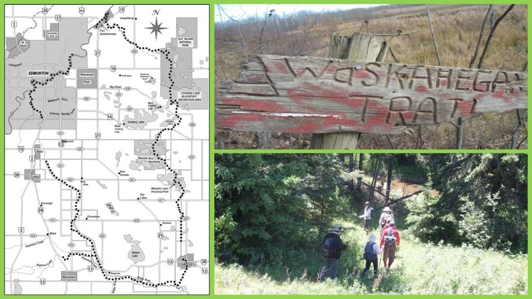
Photo credit: Waskahegan Trail Association
A Legacy of Cooperation: The Waskahegan Trail Association
The Waskahegan Trail was conceived in 1967 as a visionary Canadian Centennial project, led by founder Fred Dorward and the Edmonton-Oil Capital Kiwanis Club. Inspired by Ontario’s Bruce Trail, Dorward’s goal was to create a "backcountry trail in your backyard" circling the Edmonton region. After two years of planning, the Waskahegan Trail Association (WTA) was officially incorporated in March 1969. The name Waskaheegan is the Plains Cree word for "house," honoring the area's history as a meeting place near the original Fort Edmonton trading post. Today, this 309-kilometre loop exists only because of a 55-year tradition of volunteer labor and the remarkable generosity of over 100 private landowners who allow the trail to cross their property.
The trail’s diverse path is a journey through the region's dramatic geological past, winding over the hummocky terrain of the Cooking Lake Moraine. This landscape was shaped over 10,000 years ago by the retreating Laurentide Ice Sheet, which left behind a complex "knob and kettle" topography of high ridges and deep, water-filled depressions. As the trail moves from these glacial uplands down into the deep-cut trenches of the North Saskatchewan and Battle River Valleys, hikers can see firsthand how post-glacial meltwater carved the massive valleys that define our geography today. By maintaining these connections across such varied terrain, the Association ensures the trail remains a functional and respected corridor for both wildlife and the local hiking community.
Save the Date: The WTA will hold its Annual General Meeting on Saturday, April 18, 2026, from 2:00 pm to 4:00 pm at St. Thomas Anglican Church in Sherwood Park (4 Raven Drive). All are welcome to attend to learn about upcoming trail maintenance days and the association's long-term vision for the region.
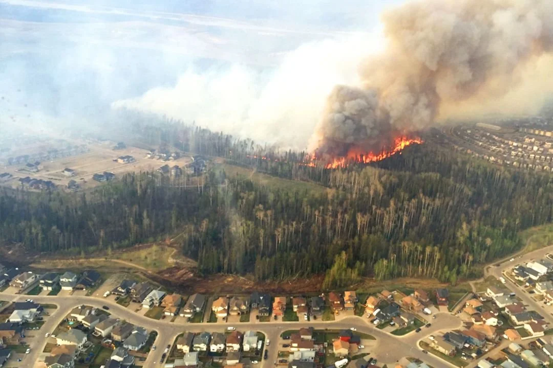
Photo credit: FireSmart Alberta
Alberta’s Growing Need for Emergency Preparedness
The 2026 wildfire season officially began in Alberta on March 1. While recent spring snow has provided some relief, the city is monitoring the dry conditions that often follow the melt. For Edmontonians, this is the time to ensure backyard fire pits are FireSmart—clearing away dry debris from the surrounding area and ensuring your spark-arrestor screen is in good repair. While no permit is required for standard recreational fire pits, residents are encouraged to check the city’s status at Fire Bans | City of Edmonton before lighting up, as high winds or dry spells can lead to temporary local restrictions.
Preparedness is key to navigating the months ahead. Experts recommend that households take time now to review their emergency plans and assemble a "72-hour kit" containing essential supplies like water, non-perishable food, medications, and copies of important documents. For those living near forested areas or the river valley, implementing FireSmart principles—such as clearing dry debris from gutters and maintaining a 1.5-metre non-combustible zone around your home—can significantly reduce the risk of structural damage. By taking these small, proactive steps today, we can help protect our homes and our natural spaces throughout the season.
To support these efforts, the City of Edmonton and the Canadian Red Cross are hosting free Get Ready in the Neighbourhood workshops throughout 2026 to help residents build practical emergency skills. Recognizing that neighbours are often the first source of support during community-wide events, these sessions equip participants with the tools to create family emergency plans, prepare 72-hour kits, and strengthen local support networks. The 2026 program runs from March through October, with the next spring workshop scheduled for Thursday, April 9, from 7 to 9 p.m. at the Meadows Community Recreation Centre (2704 17 St. NW). Residents can register through Eventbrite or visit Keep Neighbouring: Helping Neighbours to Connect | City of Edmonton to see the full schedule and learn more about building resilient communities.

Installed in May 2018, Carbon Copy is a surrealist monument by artists Caitlind r.c. Brown and Wayne Garrett, that transforms a 1988 Plymouth Caravelle into a vertical "digital glitch." Located in Edmonton’s Brewery District, the sculpture serves as a witty, illuminated commentary on North American car culture and the intersection of the physical and digital worlds.
Photo credit: Michael Janz Facebook
Comment or Contributions
Please note that articles may not reflect the position of NSRVCS. River Valley News is meant to be a clearinghouse for the variety of opinions and ideas about Edmonton’s River Valley.
Email river valley photos, event information, comments, or questions to nsrivervalley@gmail.com.
Forward this link to anyone you think may want to sign up for this newsletter https://www.edmontonrivervalley.org/newsletter-signup